
Local Sites, Geodiversity and Geoconservation
Geodiversity is the variety of rocks, minerals, fossils, landforms, soils, sediments and natural processes. Geodiversity also provides a link between people, landscapes and culture and can include such things as monuments, industrial archaeology and building stones. In other words, it influences the character of our natural and built environment, helping to define where we live and our ‘sense of place’. The county has a wealth of geological interest – from significant formations of Jurassic and Cretaceous rock (millions of years old), including chalk, limestone, sandstone and clays, to important Quaternary deposits (thousands of years old) such as gravels, sand, peat, silt and lake marls.
Important natural history sites in the UK can be given statutory protection (i.e. in law) by being designated by Natural England as Sites of Special Scientific Interest (SSSIs). This designation can be given for biological or geological value. There are 10 sites in Cambridgeshire that are geological SSSIs. There are many other sites that have geological value and these can be designated as Local Geological Sites (LGS). Previously called RIGS (Regionally Important Geological Sites) and also referred to as Geosites, these sites, and the protection of their geodiversity, need to be considered within the planning system. Our Geosites initiative was launched at the beginning of 2010 with one of its main aims being to obtain LGS designation for sites in the county that are of geological interest for their scientific, educational, historical or aesthetic value.
There is the continuing challenge to increase our knowledge of local geodiversity, but there is also considerable work still to do on identifying, recognising and conserving sites with significant geological features. There is also the need to generally adopt a more integrated approach to include geodiversity in natural and cultural heritage considerations:
‘as well as protection of sites for scientific and educational values, the wider intrinsic, cultural, aesthetic and ecological qualities of geodiversity and geoheritage and their contribution to a range of ecosystem services and environmental management are being recognised as a part of geoconservation’ (Gordon et al. 2023).
We are working to designate sites that can tell the story of the geological history of Cambridgeshire, linking this local heritage to the rest of the UK and worldwide geology. Many of these sites are likely to have public access and can be used by community groups and the general public to enjoy discovering their local landscape (although designation does not imply nor require public access).
We have recently started collecting information on sites with geological value in the county to list and map them as ‘Candidate’ LGS. We will then liaise with their landowners to propose their designation as full LGS. For information on candidate LGS mapping and LGS designation see our LGS leaflet. For further information see the leaflet produced by GeoConservation UK.


")
Cambridgeshire’s Local Geological Sites
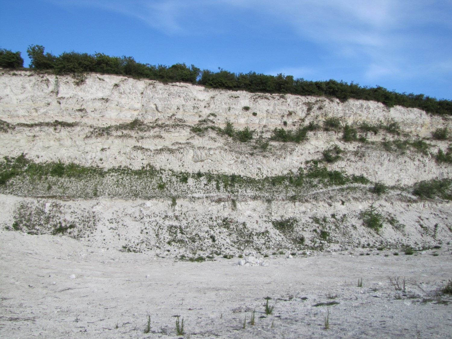
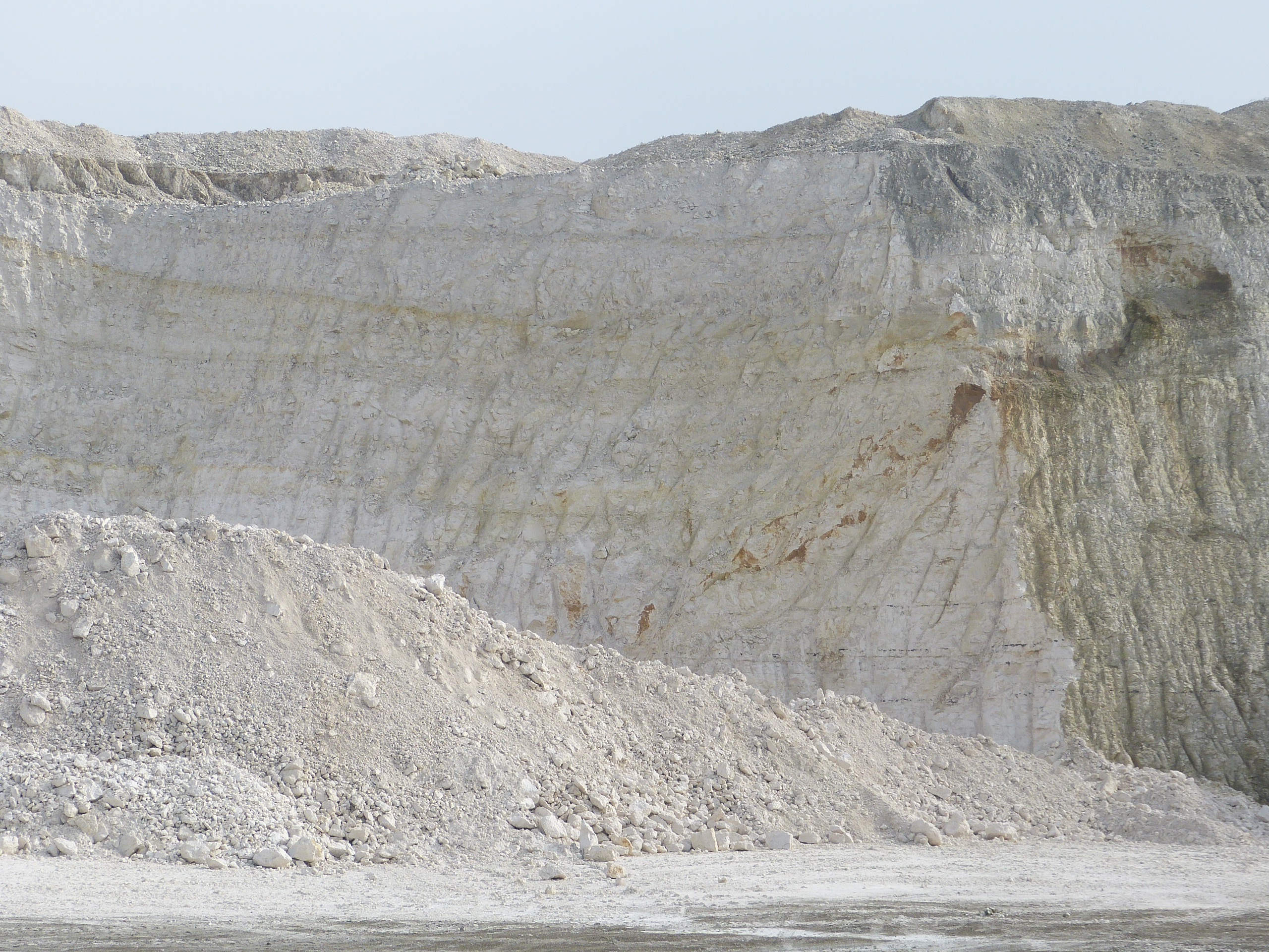
Jurassic clays and limestones, Cretaceous clays, sandstones and chalk and significant Quaternary deposits from both the Pleistocene and the Holocene – these all contribute to the fascinating geology of the county. The Quaternary deposits of the Fens are of particular importance due to their record of geologically recent climate and landscape change. Brickmaking, quarrying for ‘clunch’, coprolite digging, gravel extraction, peat digging and land drainage on an immense scale have all transformed the landscape and played a major role in creating a rich local culture that is only now being revealed.


Geological SSSIs in Cambridgeshire
The 11 sites in the county which currently have SSSI designation for geological value are Ely Pits and Meadows, Shippea Hill in East Cambs, Traveller’s Rest Pit in Cambridge, Adventurer’s Land in Fenland, Upware South Pit, Upware Bridge North Pit, two pits at Barrington in South Cambs (Barrington Pit and Barrington Chalk Pit), Histon Road in Cambridge, Eye Gravel Pit near Peterborough and Warboys Clay Pit. Most of these sites have limited or no access and it may also be very difficult to see the geological interest, even if there is public access. Some are working pits and not open for visits as safety is an issue. Please check with the landowner before considering any visit.
Local Geological Sites (LGS) in Cambridgeshire
So far, 21 sites have been given Local Geological Site designation in Cambridgeshire (in addition to 6 in the Peterborough District). The first was East Pit in Cherry Hinton, a very important Chalk site and the second was Nine Wells, one of the characteristic chalk springs found in the south of the county. Both sites are open to the public and are safe to visit. East Pit is a nature reserve and biological SSSI owned and managed by the Wildlife Trust and Nine Wells is a Local Nature Reserve managed by Cambridge City Council.
The next site to be designated was the Great Fen: Holme Fen and Whittlesea Mere. This is the northern part of The Great Fen and consists of a large area of fenland to the east of Holme and the north west of Ramsey. It has a number of features relating to Holocene history including Lake Marl from the mere and the deepest deposits of Peat remaining in the Fens. It is owned by the local Wildlife Trust and Natural England and has several walking routes open to the public. Two more sites, in Burwell, were then designated – Carter’s Pit and Castle Spring, both significant Chalk sites. The Pit is owned by East Cambs DC and the Spring by Burwell PC and both have open access. In October 2021 Orwell Clunch Pit, owned by Orwell Parish Council, was designated a LGS.
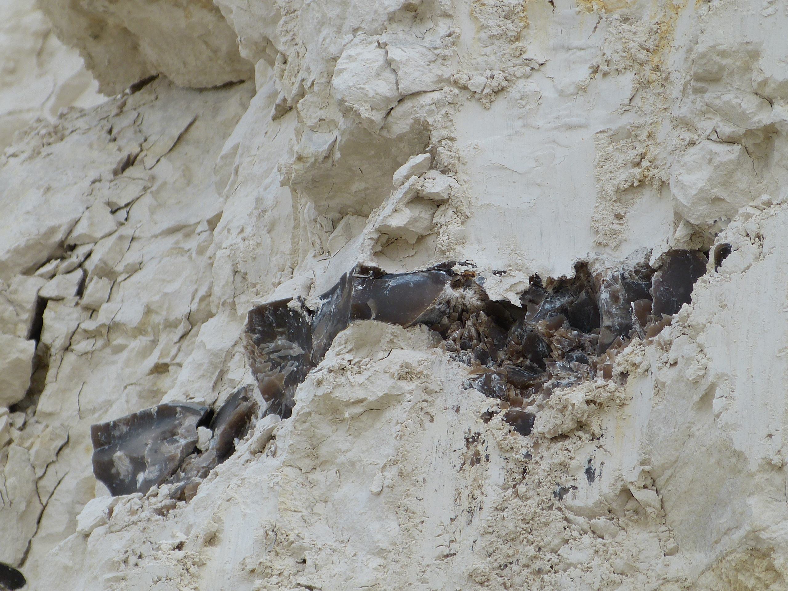
In October 2022, 2 more sites were designated as LGS. These are Fowlmere Springs and Stapleford Parish Pit and in February 2023 3 more sites were designated: Isleham Lime Kilns, owned by East Cambs District Council, Ramsey Brick Pit and Clay Pits, part of the Great Fen, and Heydon Chalk Pit, owned by Heydon Parish Council. In October 2023, another 7 sites were recognised as LGS: Giant’s Grave in Cambridge, owned by Cambridge City Council, Reach Lode Bridge, Wicken Sedge Fen and Wicken Brick Kiln & Clay Pit, all in Wicken Fen NNR,and The Hythe, Reach owned by Reach Parish Council and Anglian Water, and two small Chalk clunch pits at Reach (the latter are not open to the public). In March 2024, part of West Pit and part of Coldham’s Common, both in Cambridge and both owned by the City Council, were designated. The first, which covers the same areas of West Pit as the (biological) SSSI except for a small area not in the LGS, has access with the LNR section but this is limited for safety reasons. The Pit has an exposure of the Chalk succession extending from the Totternhoe Stone at its base to considerably above the Melbourn Rock in the cliffs and also has the remains of Lime Kilns. Coldham’s Common LGS is publicly accessible as it covers the same area as the LNR, except for the hill and the western area which are not included. The site was extensively dug for phosphate nodules (coprolites) which came principally from the Cambridge Greensand, which was also famous for its the large number of fossils it contained, particularly those of fish but also including those of pterosaurs.
Candidate Local Geological Sites
Several Candidate Local Geological Sites have also been listed and mapped. These have been assessed as likely to qualify for LGS designation and are now being reviewed alongside liaison with the landowners. Advice on the geoconservation of geological features of interest will be provided and we hope to propose the sites for designation as LGS in the near future. The sites include part of the shore of Grafham Water, part of the site of Soham Mere, Beechwoods Nature Reserve, Gamlingay Cinques Nature Reserve, Fulbourn Fen, Coploe Hill Chalk Pit and Anglesey Abbey Pit.


The Peterborough Geology Audit ‘On This Rock’
In 2000, an excellent summary of the District’s geology was published by Peterborough Environment City Trust. It included details of the local RIGS sites as well as a description of the local geology. Although some of the information is now out of date, the document is still a valuable resource for guiding geoconservation in the area. The document can be downloaded in two parts.
