
Wicken Fen
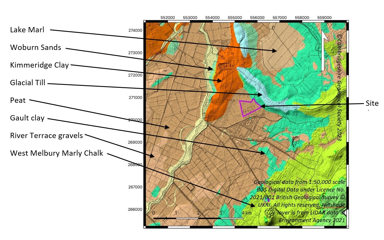
There are three Local Geological Sites within Wicken Fen Nature Reserve. Two of them were designated for their Quaternary geology – deposits that tell the fascinating story of environmental and climate change in the southern fenland in the Holocene Epoch (the last approx. 12,000 years since the end of the Pleistocene glaciations. The fourth is also of historical interest as it contains the ruins of a brick kiln and an adjacent (now flooded) pit from where the Gault clay (of Cretaceous age) was dug to make the bricks.
Sedge Fen and Wicken Fen Brick Kiln and Clay Pit can be seen on a visit to Wicken Fen (entrance and parking charges apply unless you are a NT member). Reach Lode Bridge can be reached by Rights of Way from near the entrance to Wicken Fen (without paying the entrance fee) or the villages of Reach (nearest), Upware or Burwell.
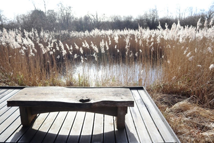
Sedge Fen
The Sedge Fen peat and overlying lake (shell) marl sequence is of local and regional significance since it provides a record of changing vegetation and depositional environments over the Neolithic-Medieval interval. The pollen analysis clearly shows a succession of vegetation from Neolithic mixed-oak woodland with lime and elm through to woodland with birch, alder and hazel. The site has played an important role in geological research (Godwin) and is now, as part of the National Trust’s Wicken Fen, an excellent place to learn about fenland environmental history and past links to the local economy.
It was also an important site in the research undertaken by Sir Harry Godwin in the early 20th century: Godwin, H. 1940. Studies of the post-Glacial history of British vegetation; III. Fenland pollen diagrams; IV. Post-Glacial changes of relative land- and sea-level in the English Fenland. Philosophical Transactions of the Royal Society of London: Series B. Biological Sciences. No. 570. Vol 230. pp. 239-303.
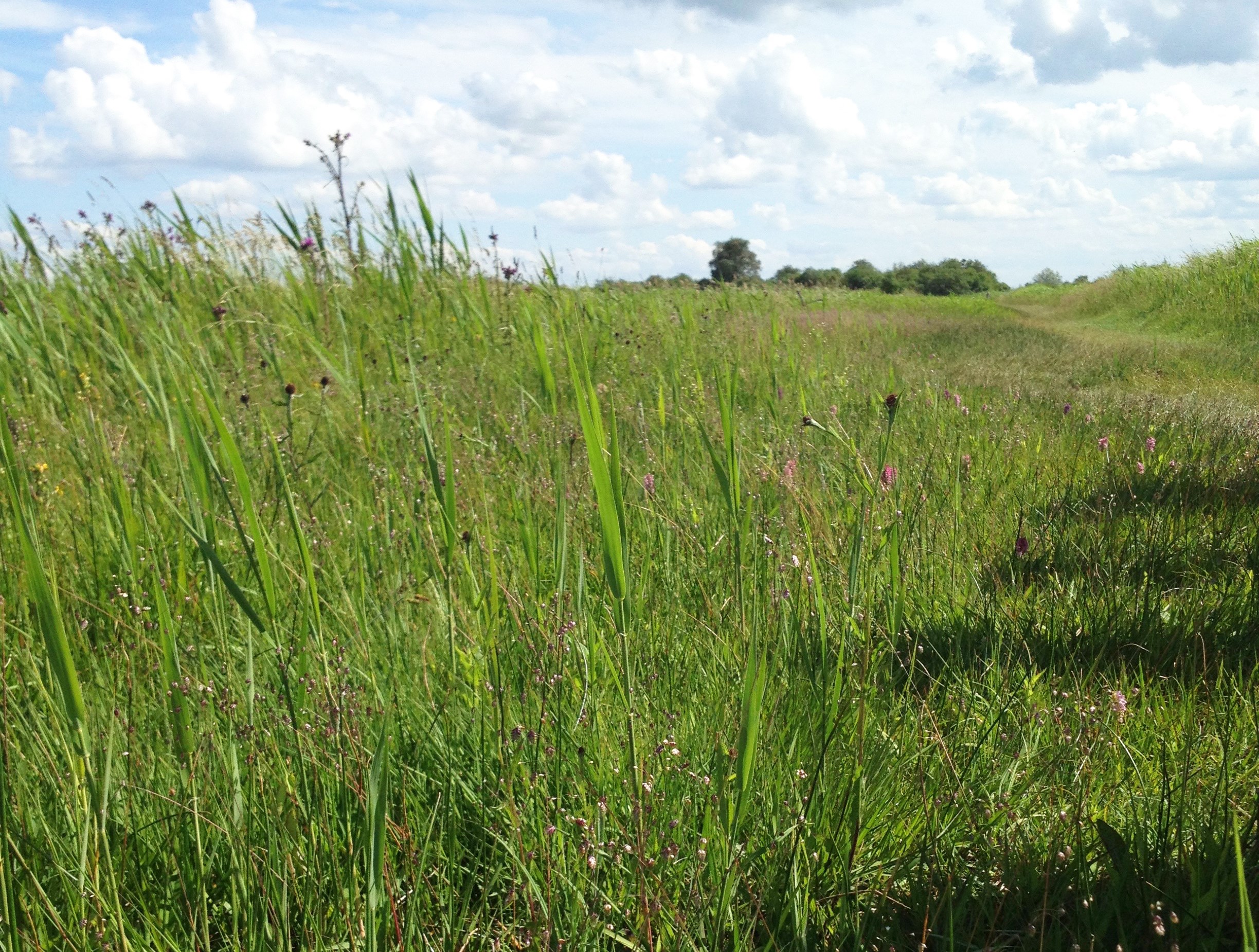
The site can be seen (within Wicken Fen Nature Reserve) on a walk along Sedge Fen Drove or on a shorter route along the accessible boardwalk. Details of the environmental history at the site will be available soon in a leaflet about the geological research of Holocene environments at Wicken Fen.
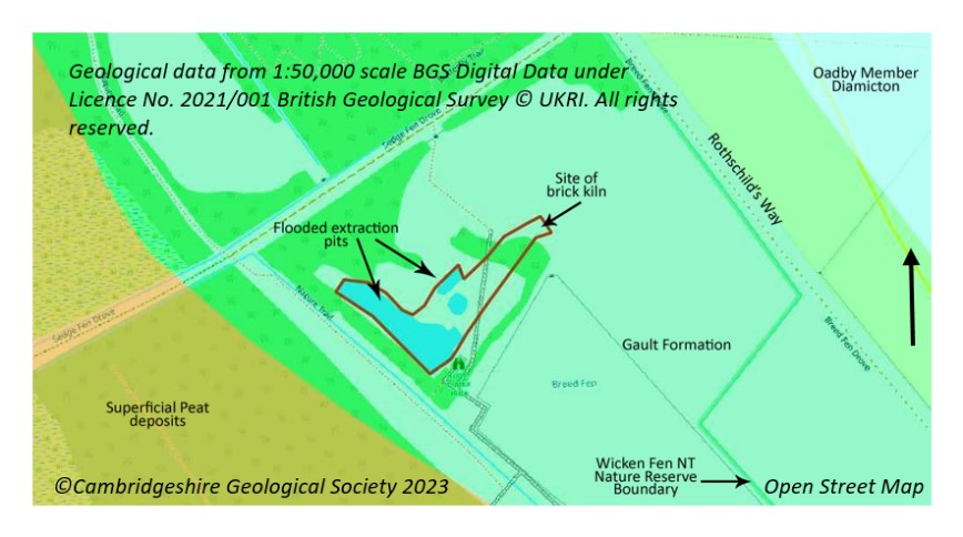
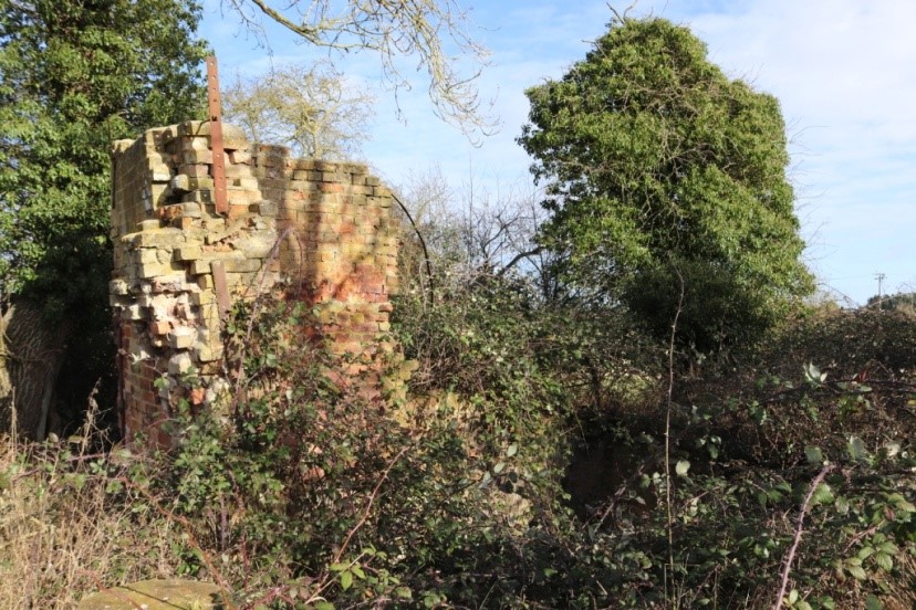
Wicken Fen Brick Kiln and Clay Pit
This is a rare combination of a preserved, old brick kiln with associated Gault clay pit (now flooded). Representative of local economic links to geology from the 1800s, there is an interpretation board on brick making on site. The pit is typical of the local Gault clay pits with the clay being used for local brick making or lining the many lodes in this part of the fen edge. The pit is now filled with water and managed for wildlife. Access is along the Boardwalk Trail and then take the Woodland Walk to the pond – the brick kiln can be seen nearby (behind a wire fence).
Gault clay formed in the early Cretaceous Period from the mud at the bottom of a relatively shallow sea. It is a calcareous clay that is older than, and therefore underlies, the Chalk along this south eastern part of the Fens. Like the Cambridge Greensand (a thin band of sandy rock that forms the base of the oldest layer of the Chalk – the West Melbury Marly Chalk), in places, the Gault contains phosphatic nodules (coprolites) that were ‘mined’ as part of an extensive local industry along this part of the fen edge,
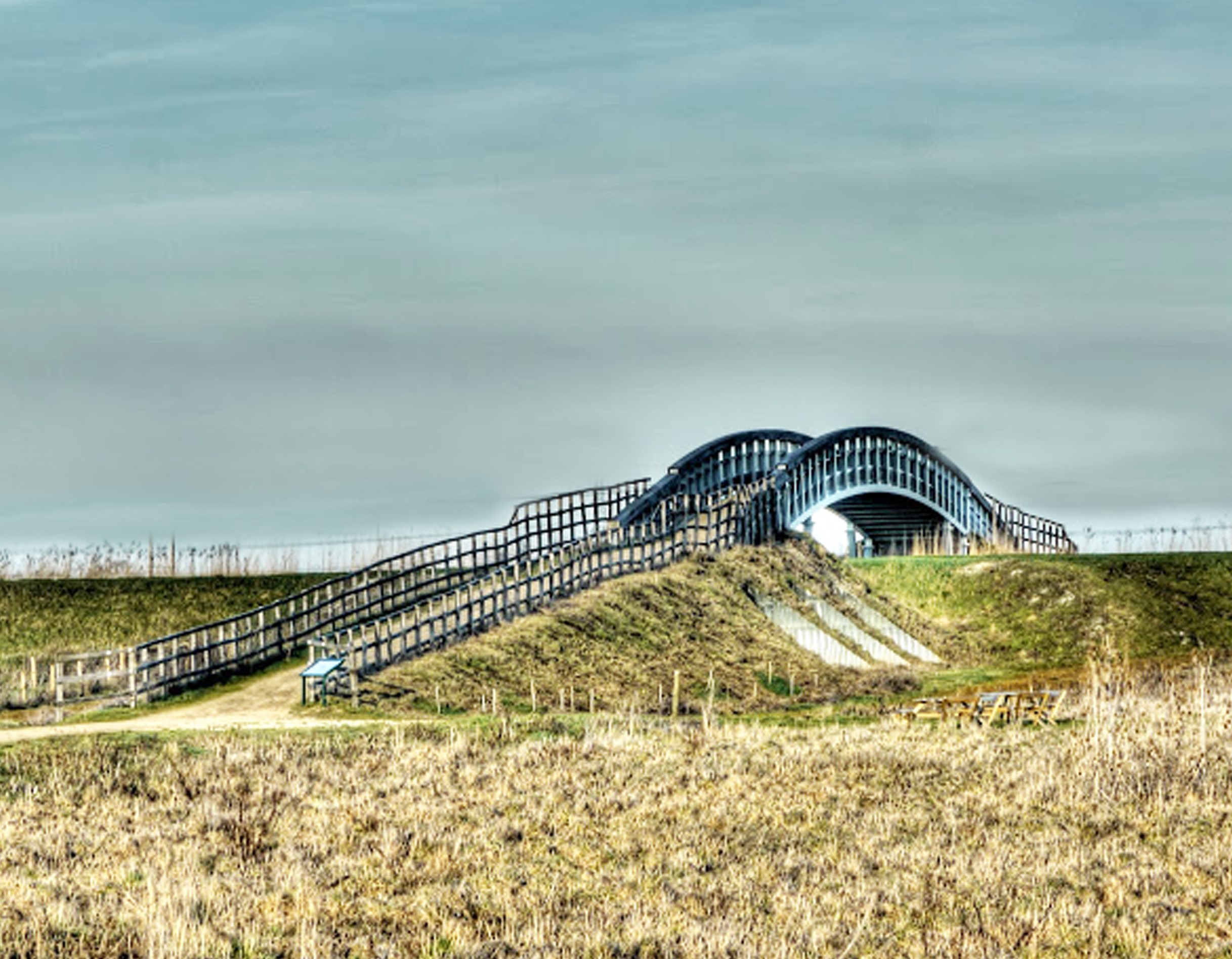
Reach Lode Bridge
Research at the site found the channel-form of abandoned river channel (palaeochannel). The radiocarbon dated fluvial palaeochannel sequence here (with associated pollen analysis) provided a rare chance to investigate Holocene vegetation and climate change. The sequence is of local and regional significance since it provides a securely dated record of changing vegetation and depositional environments over much of the Holocene. The water-logged fluvial deposits in the palaeochannel have the potential to preserve plant and animal fossils, as well as archaeological material. Following the existence of the palaeochannel, a man made lode was established here in Roman times, later used for transport by the local clunch (chalk) quarrying and coprolite industries to the south.
The site is on a public Right of Way in a fairly remote part of the fen and a visit gives an appreciation of the local landscape character of this part of the fen edge. Details of the environmental history at the site will be available soon in a leaflet about the geological research of Holocene environments at Wicken Fen.


Reach
The village of Reach is situated on the edge of the low, flat fenland, on a peninsula of land that extends out from the northeast – southwest trending Chalk escarpment to the south where the land gradually rises through a succession of Chalk rocks. Starting with the West Melbury Marly Chalk, a clayey chalk that mostly forms lower land. Between this and the next youngest, the Zig Zag Chalk, is a hard band, the Totternhoe Stone, which also caps the small hill to the south of the village.
The hill forming the centre of Reach has been extensively quarried for clunch (used as a building stone). At the top of the quarry, the harder and higher quality, Totternhoe Stone was found. Much of this was shipped out by barge from the port on the Lode at the lowest end of the village. Two small quarry sites on the hill have been designated as Local Geological Sites but they do not have public access. They contain ‘cliffs’ of the West Melbury Marly Chalk which is unusually white and hard here.

To the north, on the edge of the village and at the end of Reach Lode, is The Hythe owned partly by the Parish Council and partly by Anglian Water. This is also designated a Local Geological Site due to the research carried out here on its Holocene deposits. The peat sequence and overlying fluvial silt here is of local and regional significance since it provides a securely dated record of changing vegetation and depositional environments over the Neolithic-Roman interval. The research carried out at the site includes a pollen analysis that clearly shows a succession of vegetation from Neolithic mixed-oak woodland through progressive woodland clearance to the establishment of agricultural activity. Peat accumulation began at The Hythe in the Neolithic period, c. 5500 years calBP, and ended around 1900 years calBP, presumably as a result of the Romans constructing Reach ‘Slade’, the first artificial water course (lode) leading directly from the village to the River Cam. The establishment of the lode by the Romans, and the later establishment of the Hythe in the Saxon and Medieval periods are connected to the history of quarrying of clunch and coprolites in the local area.


