Castle Spring, Burwell LGS and Carter’s Pit, Burwell LGS

These two sites, 400m apart in Burwell, are linked by the presence of the Cretaceous Grey Chalk Totternhoe Stone horizon – a famous and ubiquitous, East Cambridgeshire building stone. The two sites (each an LGS) have been chosen due to their importance both to the area and to the understanding of the local geology. The CGS recently led a field trip to the Burwell Geological sites. A report of this trip can be found here.

Geology of the area

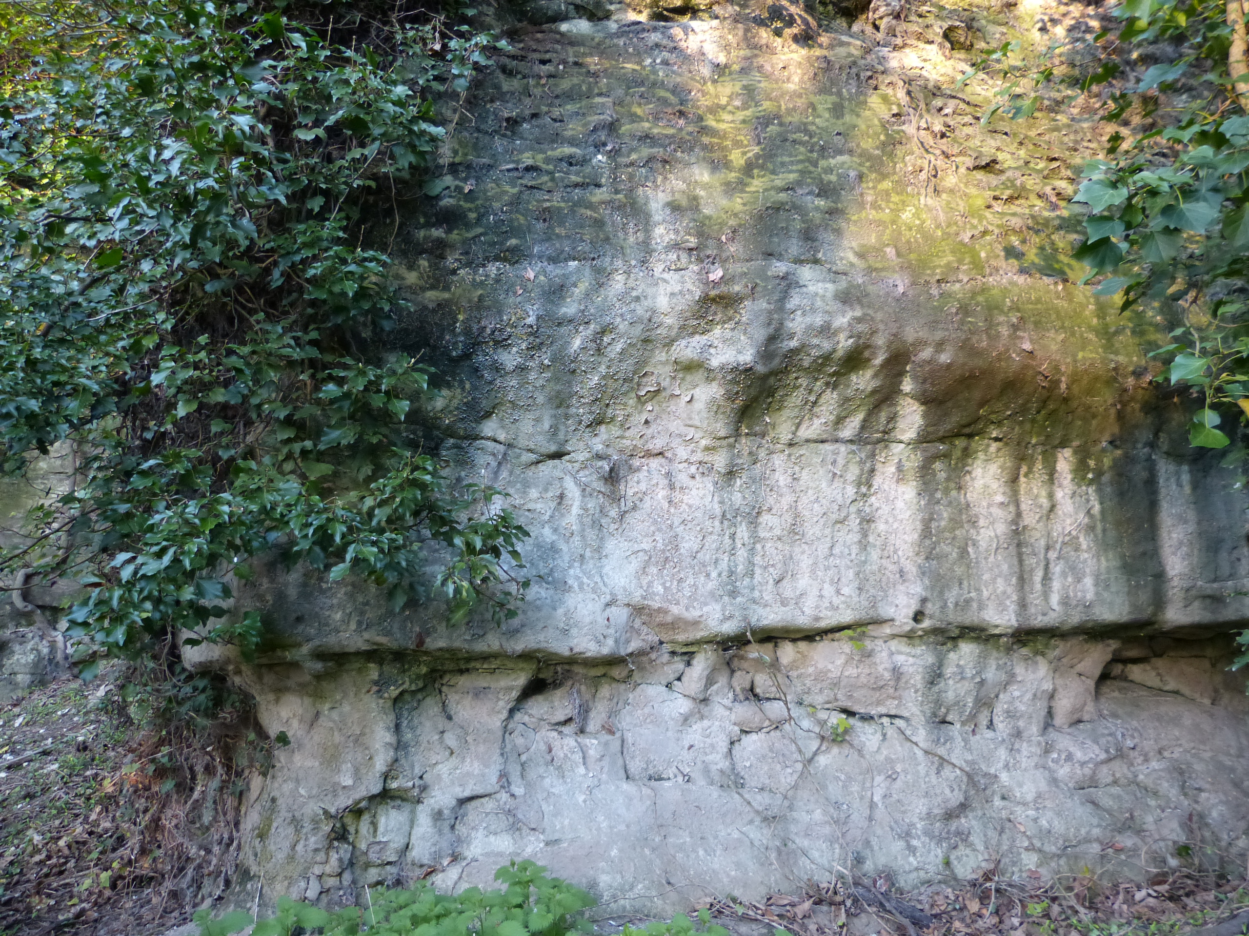
The village gently slopes from the High Town area around St Mary’s church down to the fen level at North Street (at the far north west). The bulk of the bedrock is Grey (Lower) Chalk, younger than 100 million years old and the village straddles the Totternhoe Stone horizon. The Totternhoe Stone is a recognisable horizon roughly in the middle of the Grey Chalk approximately 6 m thick. It is harder than the rest of the Grey Chalk and is typified by springs emanating near to its base. The Totternhoe is more fissured than the less pervious marly chalk below, giving rise to the springs. The Totternhoe Stone is locally termed Burwell Rock or Clunch and has been extensively quarried in the past from the south east part of the village.

In terms of lithology, the West Melbury Chalky Marl is a buff/grey, soft, clayey chalk with some traces of Glauconite: the high clay content makes it almost impermeable. The Totternhoe Stone is a grey, harder chalk which contains very small fossil fragments to give a slightly “gritty” nature. The highest layer seen, the Zig Zag Chalk, is a slightly purer grey / off white chalk, blocky in appearance. This latter makes up the quarry wall in Carter’s Pit.

More information on the economic geology of Burwell

Download our LGS Burwell Carter’s Pit leaflet:

Download our LGS Burwell Castle Spring leaflet:

The Spring: The junction of the Totternhoe Stone (aka Burwell Rock) can be seen on top of the West Melbury Marly Chalk. As this latter rock is much more clay rich than the overlying Totternhoe Stone, it acts as a natural spring line throughout the Eastern Fen Edge of Cambridgeshire (see Nine Wells LGS). Springs like this occur all along the Fen edge escarpment on this eastern side of Cambridgeshire. This is one of a few places where the water can be observed emanating from the bedrock. The spring site has been settled from pre-Roman times – no doubt the availability of the water was a prime driver. The spring feeds a chalk stream (the Burwell Brook) which meanders its way along the western boundary of the village to merge with Burwell Lode – an historic transport route.

Carter’s Pit: This worked-out quarry at the eastern edge of the village is rare in that the accessible quarry walls are still visible. The pit was dug to win the Totternhoe Stone, but has been worked out and backfilled so that the Zig Zag Chalk is the main horizon visible. This harder Totternhoe Stone layer forms the spine of the marked escarpment that runs south west/north east along this eastern Fen edge of Cambridgeshire. There are a string of villages nearby built upon the chalk ridge forming the higher (drier) ground. The stone was used in local buildings as well as more “famous” Cambridge colleges and Ely Cathedral. Again it is rare to have exposed bedrock accessible and visible to the general public

How to get there

The Spring is reached by entering the Burwell Castle Spring site from Mandeville Lane (behind the Guildhall). Once through the gate, bear to the left down into a hollow. Keep to the left and the spring is in front of you. Some parking beside the Guildhall may be available or the bus service from Cambridge/Newmarket stops nearby (check Bus website for schedule).

Carter’s Pit:  Access is down a housing estate road (Bloomsfield) off Isaacson Rd. At the bottom of the hill there is a sewage pumping station with yellow grit bin on the right – turn right along a path into the woodland. A short flight of steps leads to the current quarry floor and a view of the exposed cliffs. NB Take care when descending steps. Be careful of brambles which may be overgrown in some areas. Parking is best in the car park of the Gardiner Memorial Hall on the High st and then walk through Mill Lane at the back into the Bloomsfield housing estate as per the map. Or take the bus from Cambridge/Newmarket which stops on the High St (check Bus website for schedule).