
Western Plateau
The Western (Madingley) Plateau, to the west of Cambridge, is a dome-shaped area of dissected higher ground in the southern part of the county between the River Great Ouse Valley to the west and the River Cam Valley to the east.
Geology: It is underlain by Jurassic Ampthill and Kimmeridge Clays, Cretaceous Woburn Sands, Gault Clay, and the West Melbury Marly Chalk and Zig Zag Chalk Formations. There is a substantial thickness of Oadby Glacial Till (‘boulder clay’) which dates either from the Anglian glaciation (425,000 years ago) or from the Wolstonian (c 300,000 years ago). There are small stretches of River Terrace Deposits and Alluvium in the river valleys and also a few small patches of slope deposits. There is one SSSI, Barrington Chalk Pit, and one LGS, Orwell Clunch Pit.
Topography and drainage: The plateau has undulating hills, the highest parts reaching above 80m OD, and mostly gentle slopes down to the river valleys. Several springs arise in it supplying a few streams, the main ones being the Bourn Brook which almost dissects the plateau by flowing west to east in a narrow valley to join the Cam in Cambridge, and the Gransden/Waresely Dean/Abbotsley/Hen Brook system, which flows west through a wide valley into the Great Ouse at St Neots. The Millbrook/Potton Brook flows south west past Gamlingay to join the River Ivel, a tributary of the Great Ouse. Mineral springs occur e.g. the ‘sacred well’ near Knapwell arises when water flowing through the overlying Glacial Till reaches the impervious Jurassic Kimmeridge Clay.


As in many places, the current surface hides the interesting landscapes of the past – research has shown that there are deep, hidden channels under parts of the plateau, now infilled with large amounts of material which disguises their presence. Springs occur when a more impermeable rock layer is reached by water percolating down through overlying permeable deposits. Streams emanating from the springs have often cut down into the underlying bedrock, exposing the older rocks. For example, the Gransden Dean Brook (which passes through Waresley and Gransden Woods) has eroded a small valley in the Glacial Till revealing the underlying Cretaceous Woburn Sands and older Jurassic Ampthill Clay. The small brook in Overhall Grove wood (near Knapwell) has cut down through the Glacial Till into the Jurassic Kimmeridge Clay. Bourn Brook has cut down through the Glacial Till to reveal the Woburn Sands near Caxton and Bourn before flowing south east over the impermeable Gault Clay. It was once a much stronger flowing river, depositing River Terrace sands and gravels and finer Alluvium.
Soils and ecology: The Glacial Till and bedrock clay produce heavy, poorly drained soils (hanslope series) whilst there are well-drained soils on the small patches of Terrace gravels. The sandstone areas generally produce free draining areas although some wet areas occur on them. Habitats – mostly wet woodlands (many ash-maple), hedgerows, small streams, parkland with veteran trees, some neutral and acid grasslands. There are several biological SSSI in the area including several ancient woodlands on Glacial Till, known for their oxslip populations (including Gamlingay, Waresley and Gransden, Hardwick, Hayley) due to the calcareous marl soil. Many of the ‘boulder clay woodlands’ hold populations of the scarce Oxlip, a plant related to primroses that thrives in the seasonally water-logged conditions that the clayey soil of the Glacial Till provides. The Wildlife Trust has a number of nature reserves on the Plateau forming the West Cambridgeshire Hundreds Living Landscape. ‘Calcareous loam’ soil is also present on the Glacial Till. Weaveley and Sand Wood SSSI, north of Gamlingay has a mixture of free-draining Woburn Sands, in addition to ‘ill-drained’ Ampthill Clay and Glacial Till—’Few other ancient woods in Cambridgeshire possess this variation in terms of geology. Orwell clunch Pit is a biological SSSI for its chalk flora.
Gamlingay Wood is unusual as it has ‘sandy loam which overlays Boulder Clay on Greensand’ (however the geology map shows it overlies Gault Clay not the Woburn Sands in all but the far north of the wood. However, the Gault may not be very thick as the geology map (Geoindex) shows the clay only extending to the wood’s boundary , with it having disappeared from the surrounding land, exposing the Woburn Sands. ‘On the sandy loam which overlays Boulder Clay on Greensand, oak is more abundant with ash being replaced by birch. The ground flora here holds bracken Pteridium aquilinum, together with creeping soft-grass Holcus mollis. This type of vegetation is characteristic of dry oak woods on acid soils and extremely rare in the county’. It also has ‘calcareous marl type overlying Boulder Clay on Gault’. ‘Where the soil is of the calcareous marl type overlying Boulder Clay on Gault, the nationally restricted oxlip Primula elatior is a key component of the ground flora, together with dog’s mercury Mercurialis perennis, bluebell Hyacinthoides non-scripta, yellow archangel Galeobdolon luteum and wood anemone Anemone nemorosa.’
There are numerous County Wildlife Sites in the GL, many designated for their woodlands and grassland, including acid grassland on the Woburn Sands (some once part of Gamlingay Great heath). Part of the Wimpole Estate CWS lies on the border and is notable for its invertebrates (such as dragonflies and beetles).
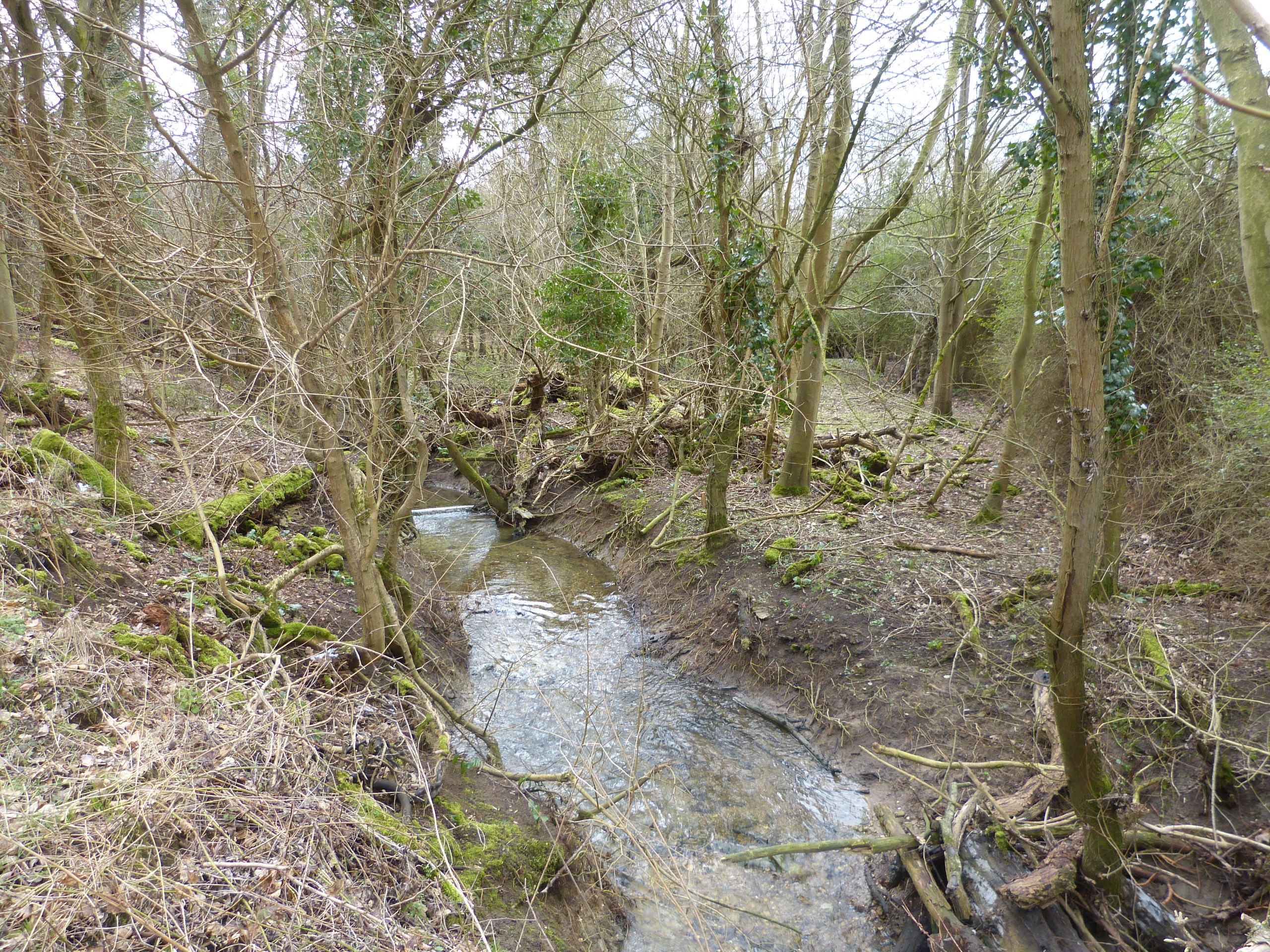
Looking south, near Waresley Wood, to the valley of the Dean Brook which lies in the Ampthill Clay of Jurassic Age.
The Glacial Till soils can be very wet in places. Overall Grove Nature Reserve
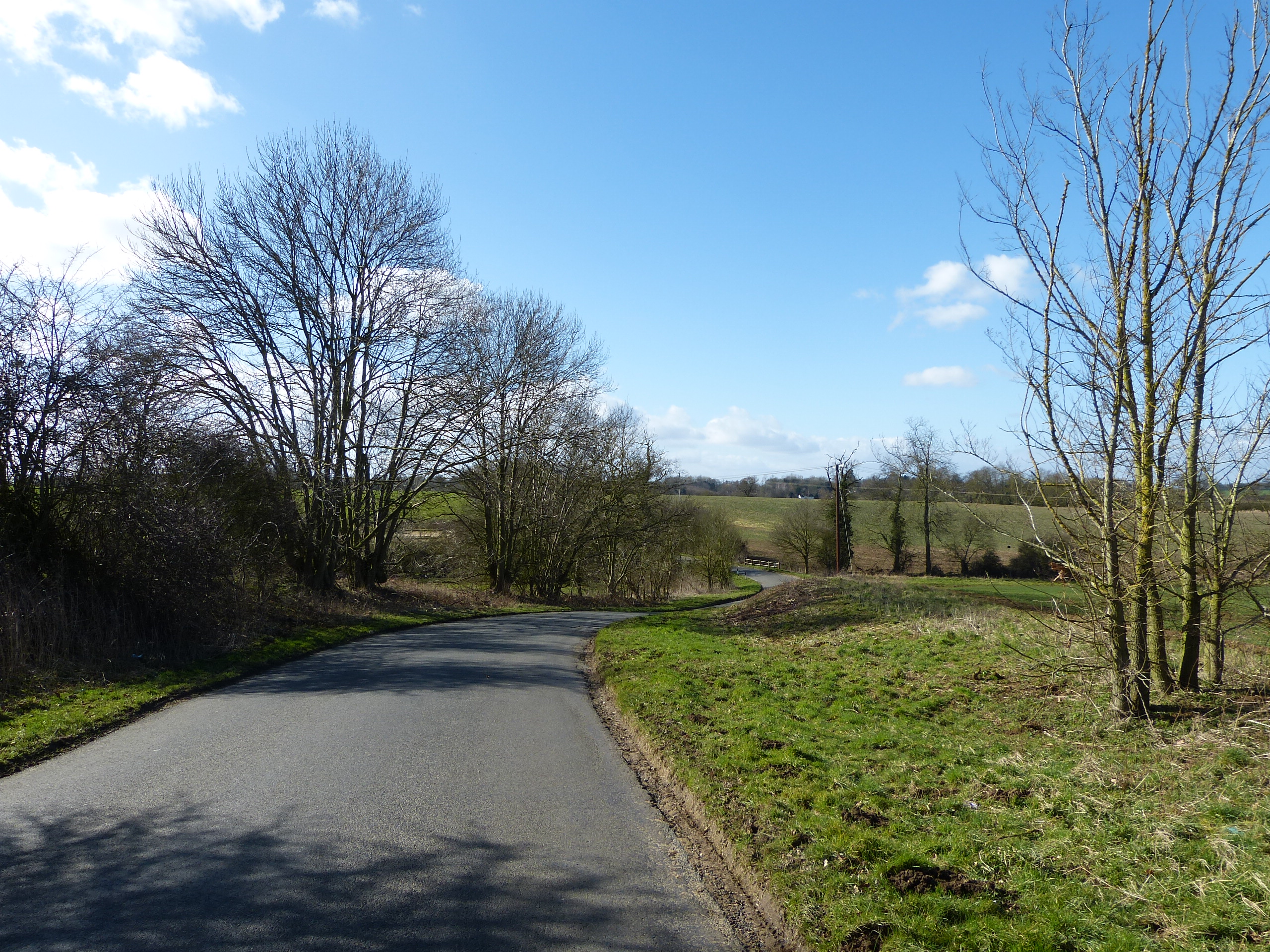
The gently rolling countryside near ‘the Hatleys’.

The windmill at Great Gransden is one of the oldest in the country. It makes use of the winds that can sweep across the plateau.
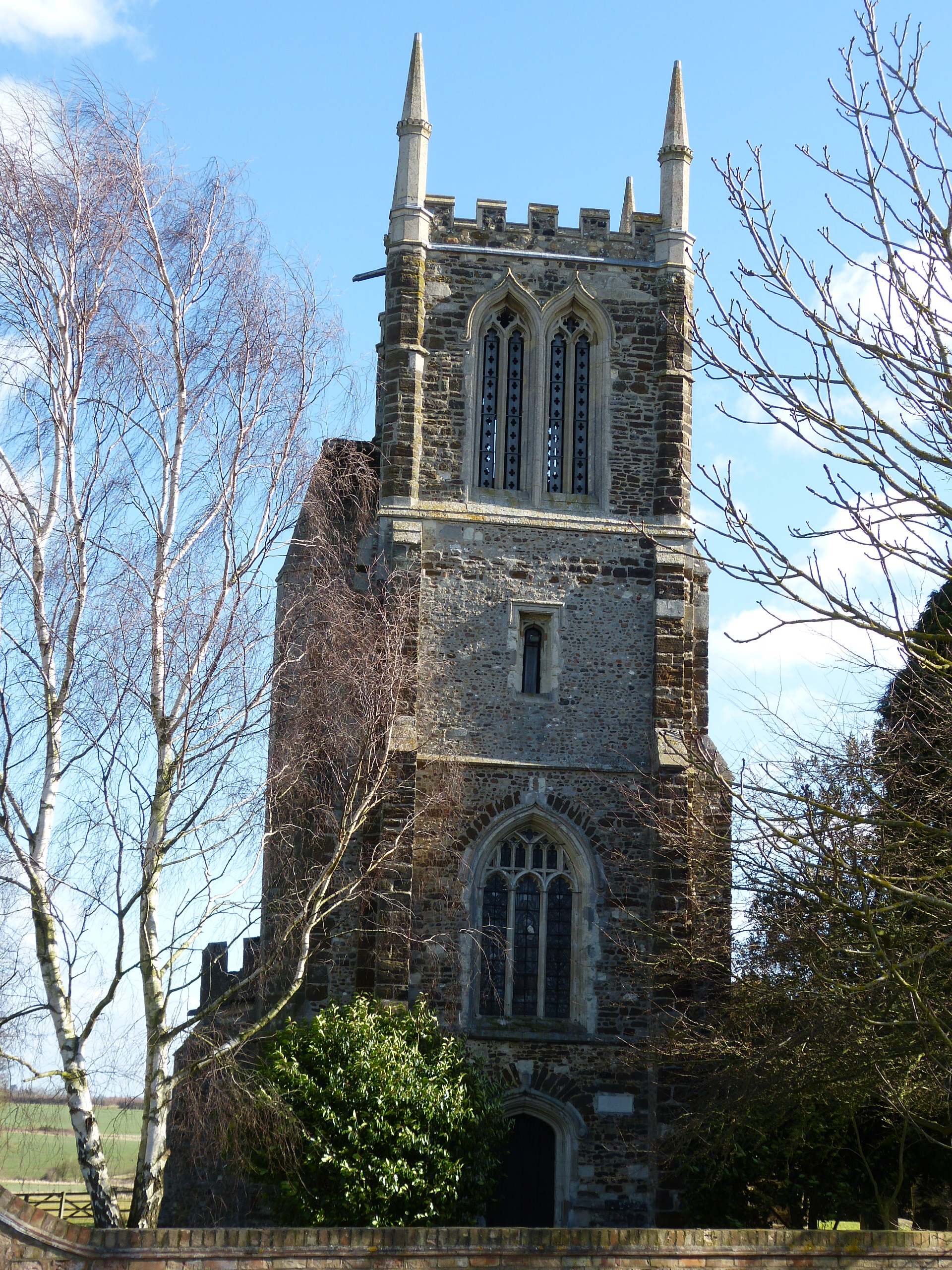
The church at Cockayne-Hatley includes local ironstone and cobbles in its walls.
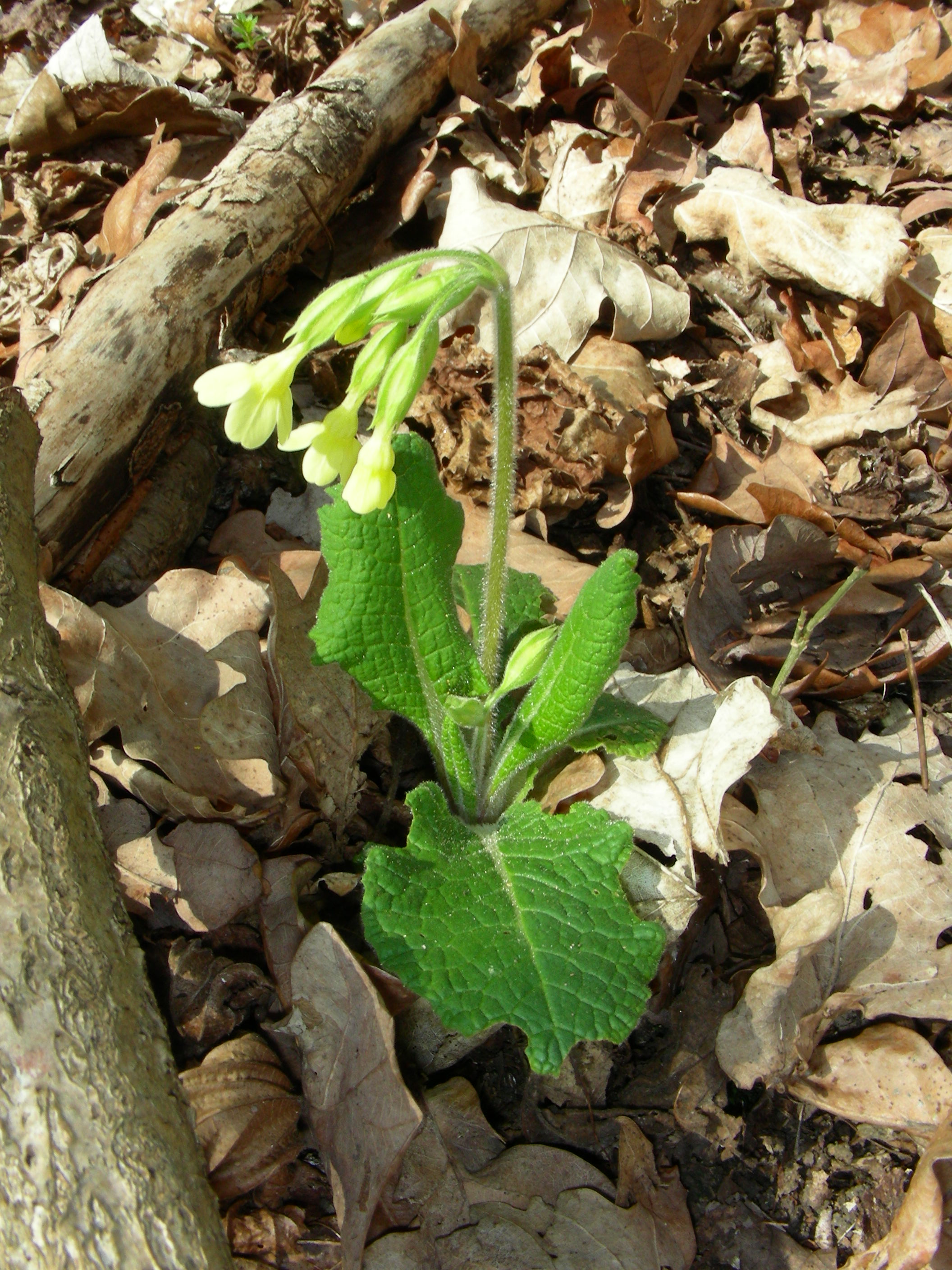
Oxlips growing in Hayley Wood
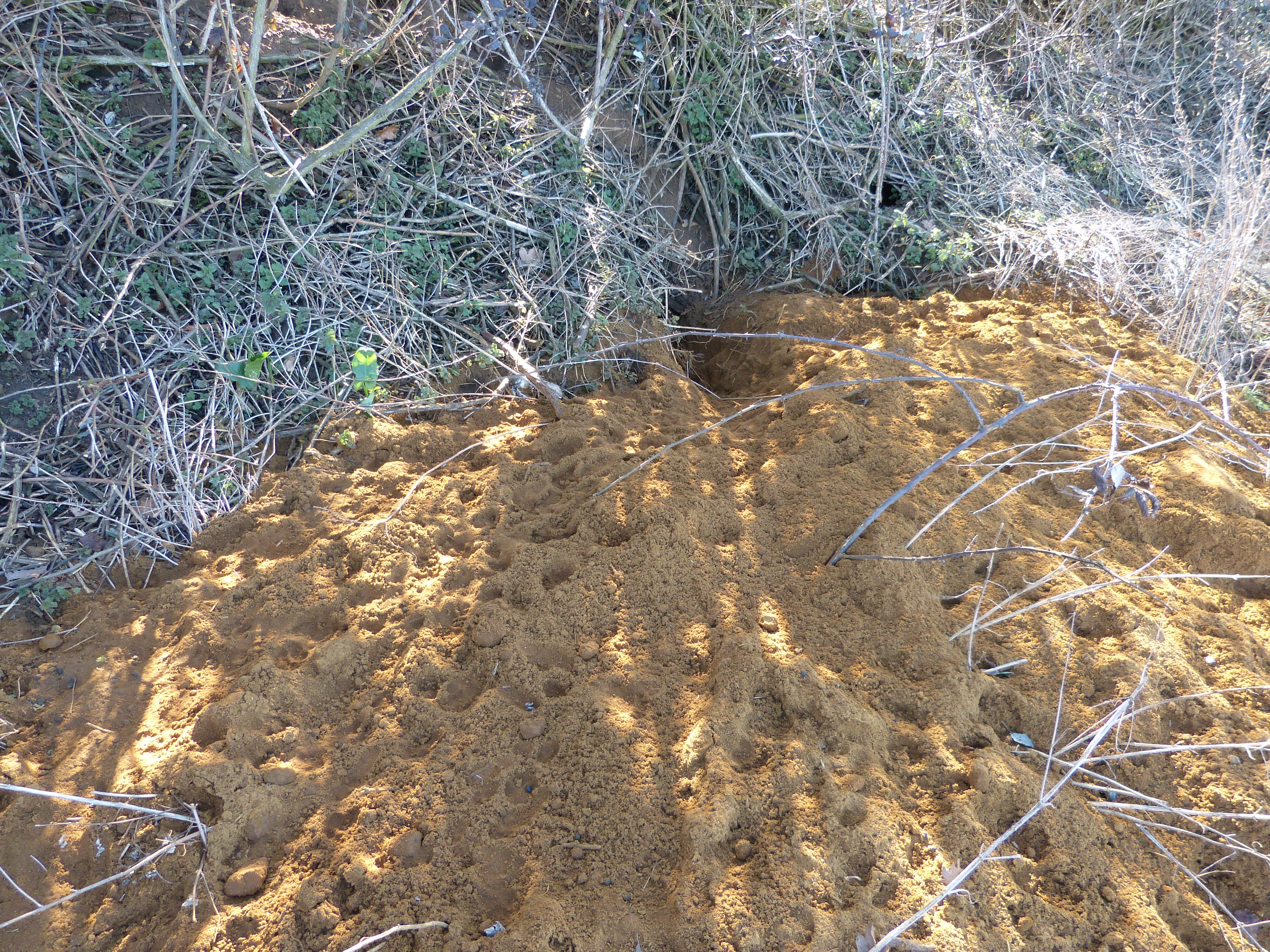
Sand from the Woburn Sands (Cretaceous Period), easily excavated by badgers!
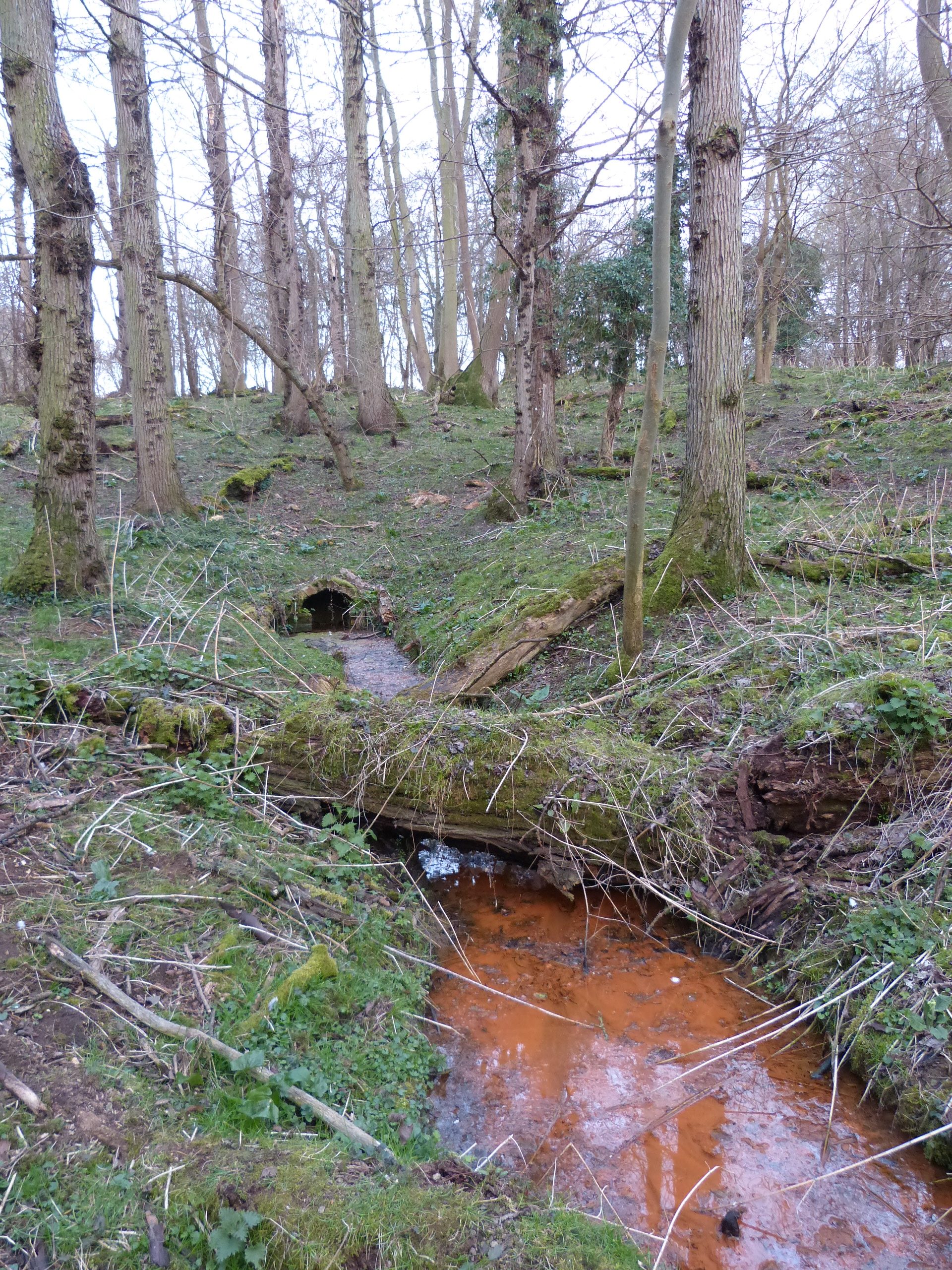
The ‘sacred well’ near Knapwell arises when water flowing through the overlying Glacial Till reaches the impervious Kimmeridge Clay (Jurassic).