
Grafham Plateau
The Grafham Plateau forms a northwest-southeast aligned dissected ridge reaching above 70m OD (and at one point 80m – Mickle Hill, on the parish boundary with Covington) between the Nene Valley (in Northamptonshire) and the Great Ouse Valley. It is bordered in the west by Northamptonshire and in the south by Bedfordshire. In the north it is adjacent to the Woolley Apron GL, which also almost dissects it in two in the centre. In the west it is adjacent to the River Ouse Valley GL.
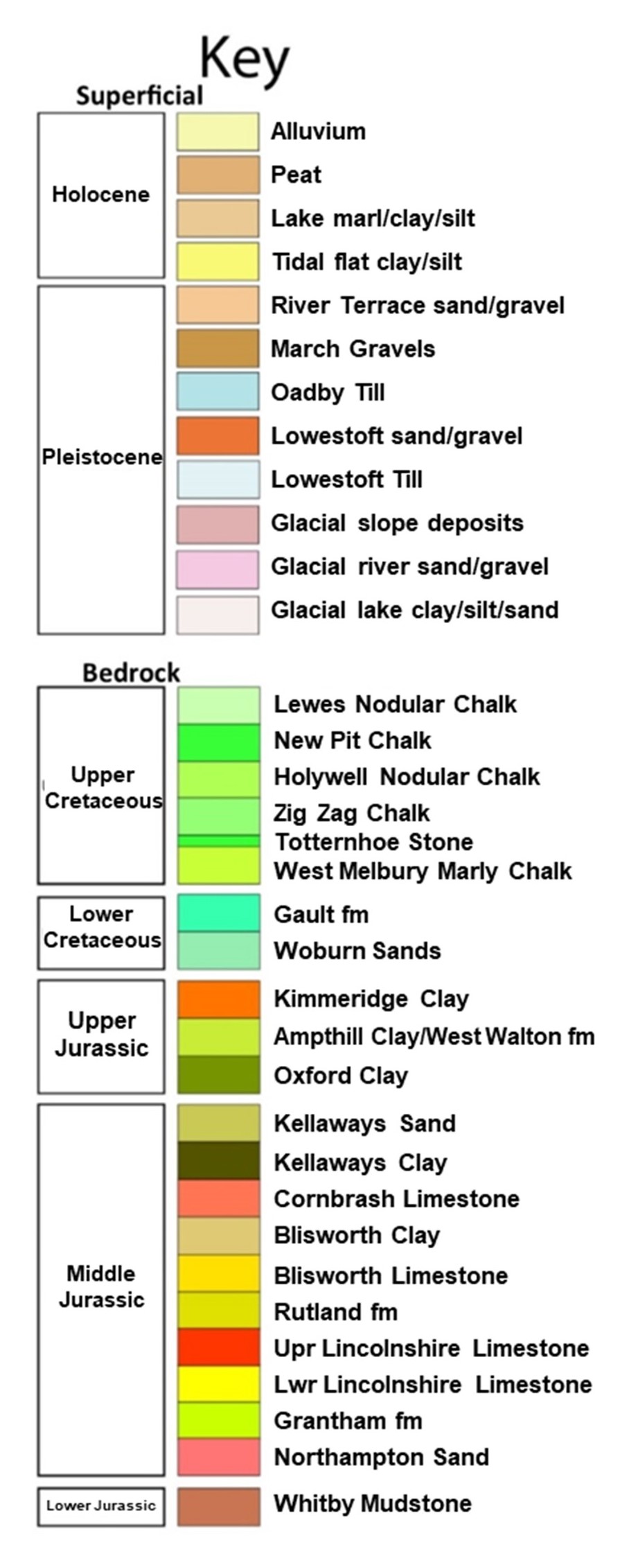
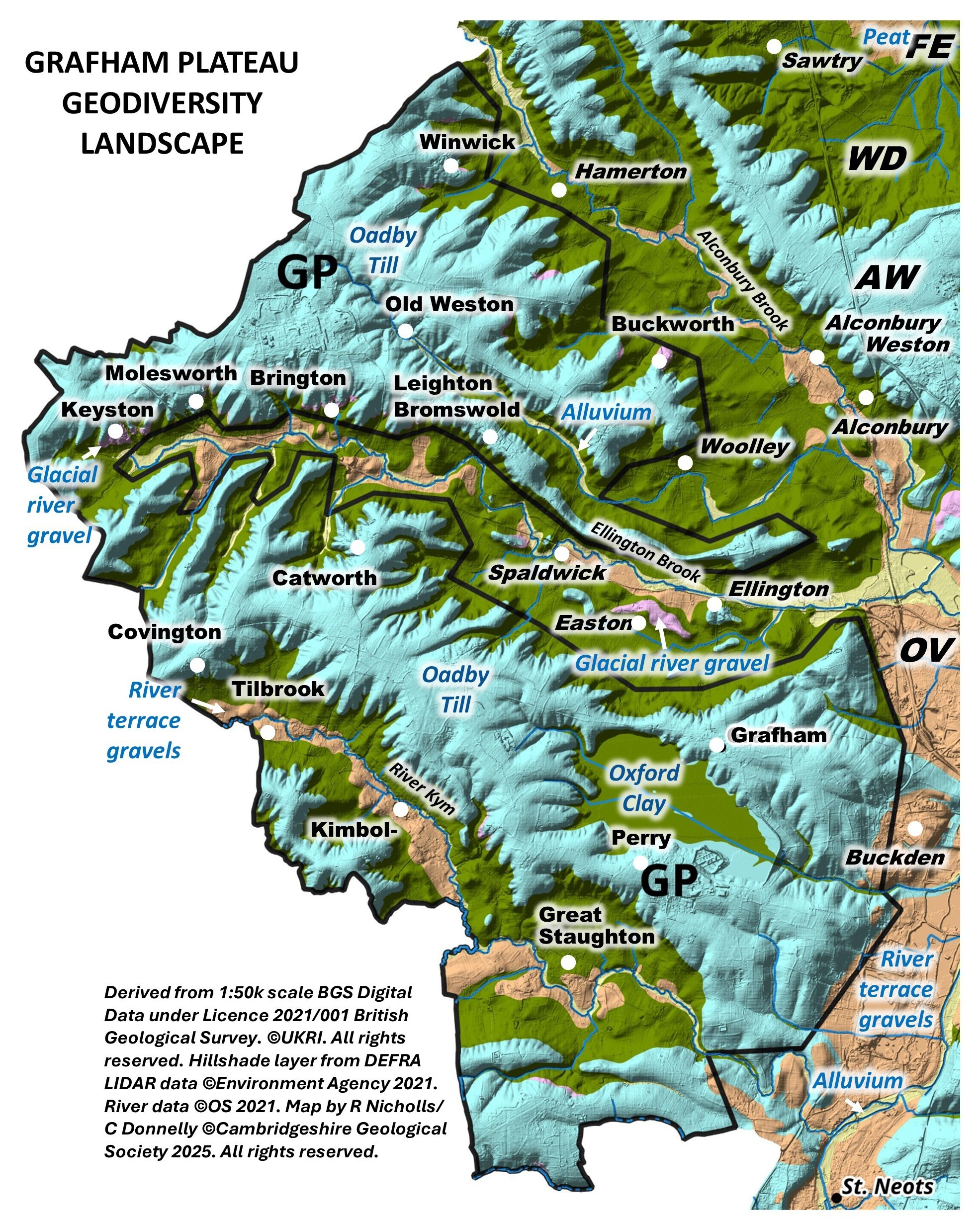
Geology: It is underlain by Oadby Glacial Till, which overlies Oxford Clay, the only in situ bedrock in this GL. The Glacial Till is currently labelled as ‘Oadby Till’ by BGS, although the classification (both in terms of dating and origin) of some of the Pleistocene tills in the region is as yest unresolved, notably the Oadby Till. Under the village of Catworth there is a large area of Chalk (considered/mapped as part of the Till), which is likely to be a Chalk raft which would have broken off from the Chalk bedrock far to the east and been brought here by ice, probably during the Anglian Glaciation about 425,000 years ago. There are stretches of River Terrace Deposits and Alluvium in the river valleys and also a few patches of Glacio-fluvial gravels.
Topography and drainage: The plateau has undulating hills and gentle slopes down to the river valleys. Several springs arise in it supplying a few streams, some of which, flow into the Woolley Apron GL, although the River Kym (River Til) flows east through the south of the GL to the River Great Ouse GL.
Soils and ecology: The Glacial Till and bedrock clay produce heavy, poorly drained soils whilst there are well-drained soils on the Glacio-fluvial and Terrace gravels. Habitats – wet woodlands, hedgerows, small streams. There are numerous County Wildlife Sites in the GL, mostly designated for their woodlands, hedgerows or pollarded willows and some grassland.


