
Alconbury Weald
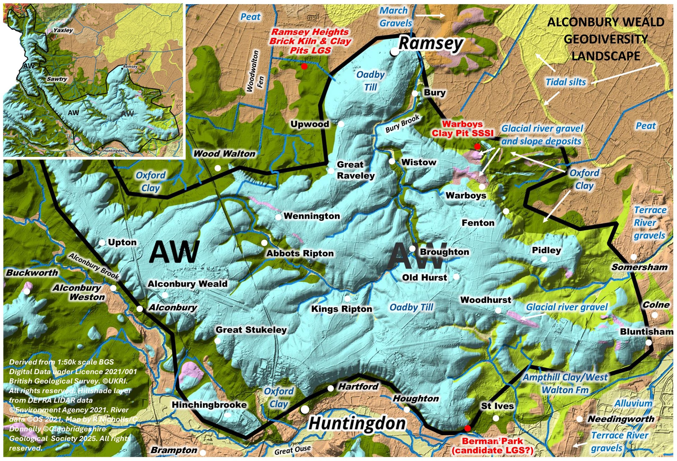
This area of higher ground forming a dissected west-east aligned ridge in the central part of the county between the River Great Ouse Valley to the south and Fen Edge to the northeast. It also extends as a narrow ridge towards the northwest, bordering Northamptonshire and lying between the Woodwalton Apron to the east and the Woolley Apron to the south. . This fragmented plateau reaches above 40m OD. There is one geological SSSI, Warboys Clay Pit, although its condition may have deteriorated and it is not publicly accessible. There are currently no LGS but one site on the southern edge is being considered as a candidate site. Monks Wood, southwest of Woodwalton village, is a NNR.
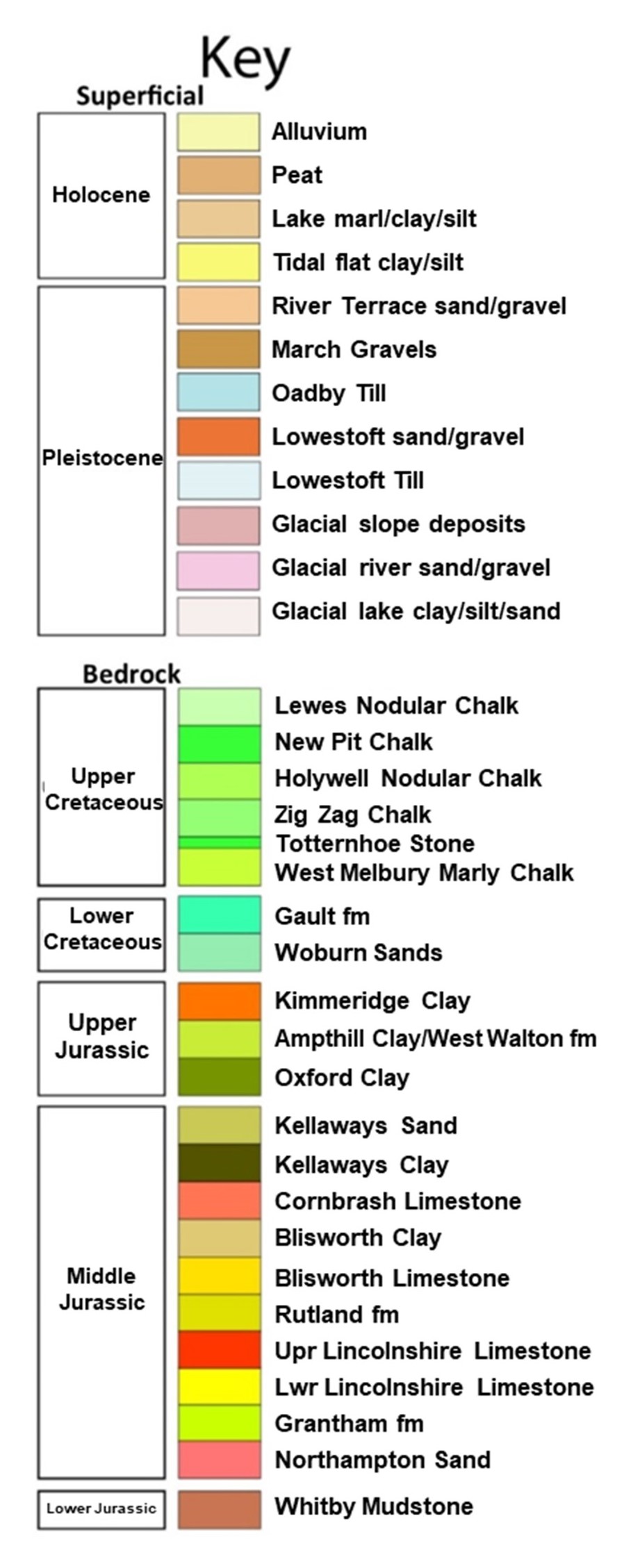
Geology: It is underlain by an appreciable thickness of Oadby Glacial Till, which overlies mostly Jurassic Oxford Clay bedrock. However, in the east, the bedrock is younger, being rocks of the West Walton Formation and overlying Ampthill Clay. The West Walton Formation contains beds of limestone known as the St Ives Rock. It is related stratigraphically to the nearby Elsworth Rock and also the Upware Limestone. There are also patches of Glacio-fluvial and slope deposits and River Terrace deposits, the latter either on the edge or along the Bury Brook.
The Glacial Till is currently labelled as ‘Oadby Till’ by BGS, although the classification (both in terms of dating and origin) of some of the Pleistocene tills in the region is as yest unresolved, notably the Oadby Till.
Topography and drainage: The plateau has relatively steep sides in some places, particularly where it is adjacent to the Fen Edge and the Ouse Valley. Bury Brook dissects the Weald and flows to Ramsey and onwards to the River Nene system. There are numerous (mineral) springs, probably arising from the junction of the till and clay, and smaller streams flow off the plateau in various directions.
Soils and ecology
The clays and till produce heavy, poorly drained soils. Habitats include wet woodlands, small streams.
More information on the Geodiversity Landscapes will be added soon.


